



How Was the Grand Canyon Formed? A Catastrophic Lake Spillover Model
Nate Loper – April 29, 2026
 If you read most park signs, you’ll find the formation of the Grand Canyon is often treated as a simple question of slow erosion and time. A river cut downward over 5.5 to 6 million years and produced the canyon we see today. At first glance that might seem reasonable. But the more closely the landscape is examined, the more that simple explanation begins to fall short. And interestingly, that explanation is losing favor among many geologists today.
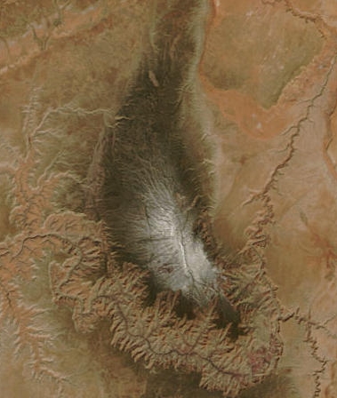
You see, the canyon is not an isolated feature. It sits within a much larger setting, and that setting must be part of the explanation. When we take a step back to look at the big picture of Grand Canyon formation and the surrounding landscape, a few things are observed. The main part of the canyon that houses the North and South Rim areas frequented by most visitors cuts directly through what’s known as the Kaibab Plateau.
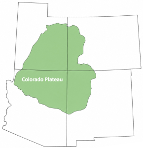
The Kaibab is a plateau on a plateau, a high-standing block of land that forms part of the much broader Colorado Plateau. This larger plateau is a 150,000 square mile uplift that encompasses the Four Corners region. Unlike most plateaus that are flat, the Colorado Plateau is not a flat tabletop. When viewed at a regional scale, it has a basin-like form, with higher margins along the rim and lower interior areas.
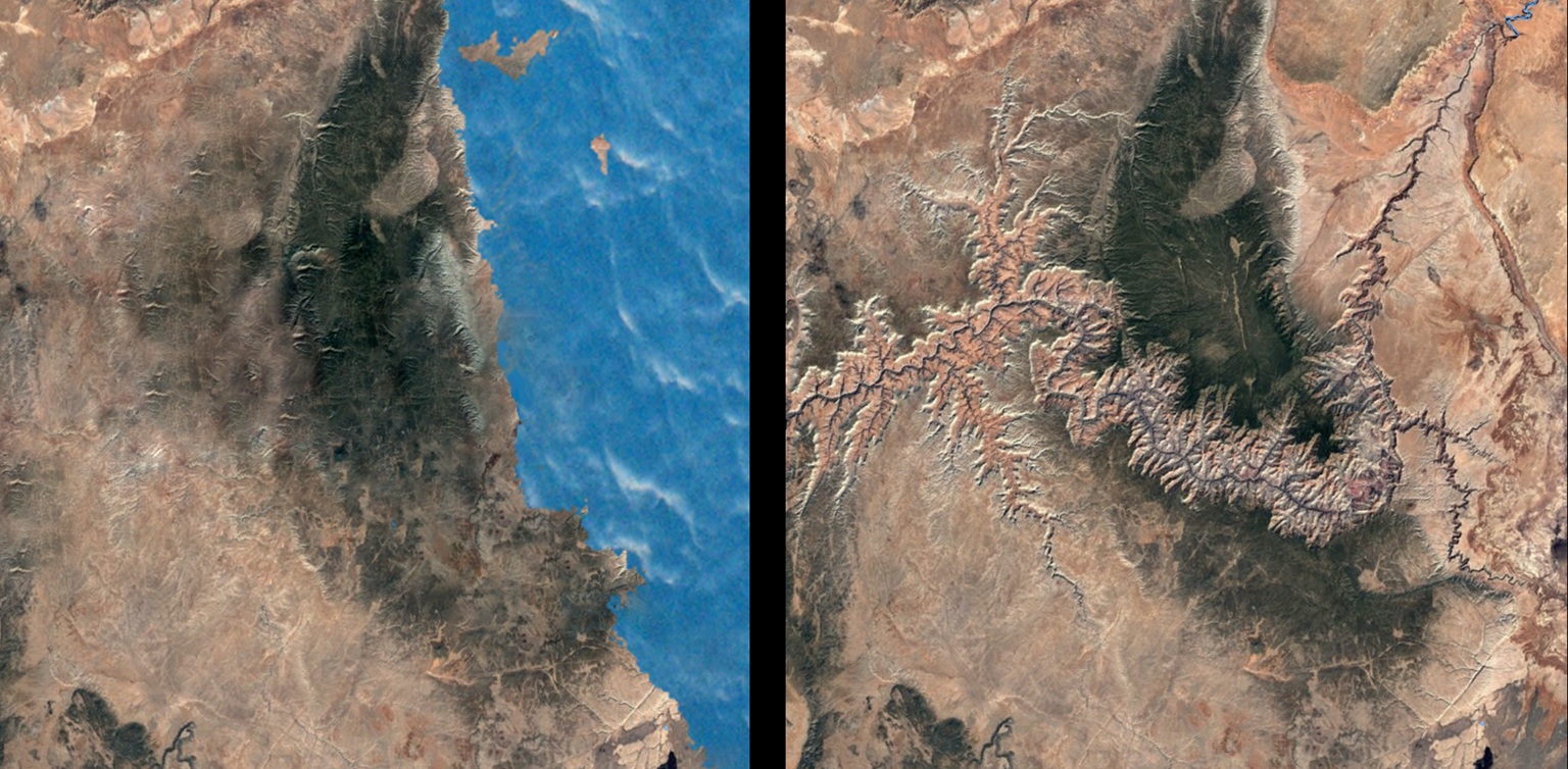
That shape matters. It means that water on the plateau does not simply drain away in all directions. It tends to drain toward and collect in internal basins. Those basins in turn direct water toward converging rivers and streams, most often exiting the Colorado Plateau via the Colorado River. However, if the Grand Canyon didn’t exist, there would be no major exit route for that water. Instead, we might end up seeing these large basins fill with water, forming huge lakes. In geology and paleoecology studies, we have direct physical evidence that such lakes did in fact exist at one point within the Colorado Plateau.
The idea of large lakes on the Colorado Plateau goes all the way back to the mid-1800s with geologists like John S. Newberry, and later expanded in the 1930s by Howell Williams and others. More modern and ongoing research in both the creation and secular geological communities has been examining the evidence for these lakes with great interest and developing models since at least the 1980s.
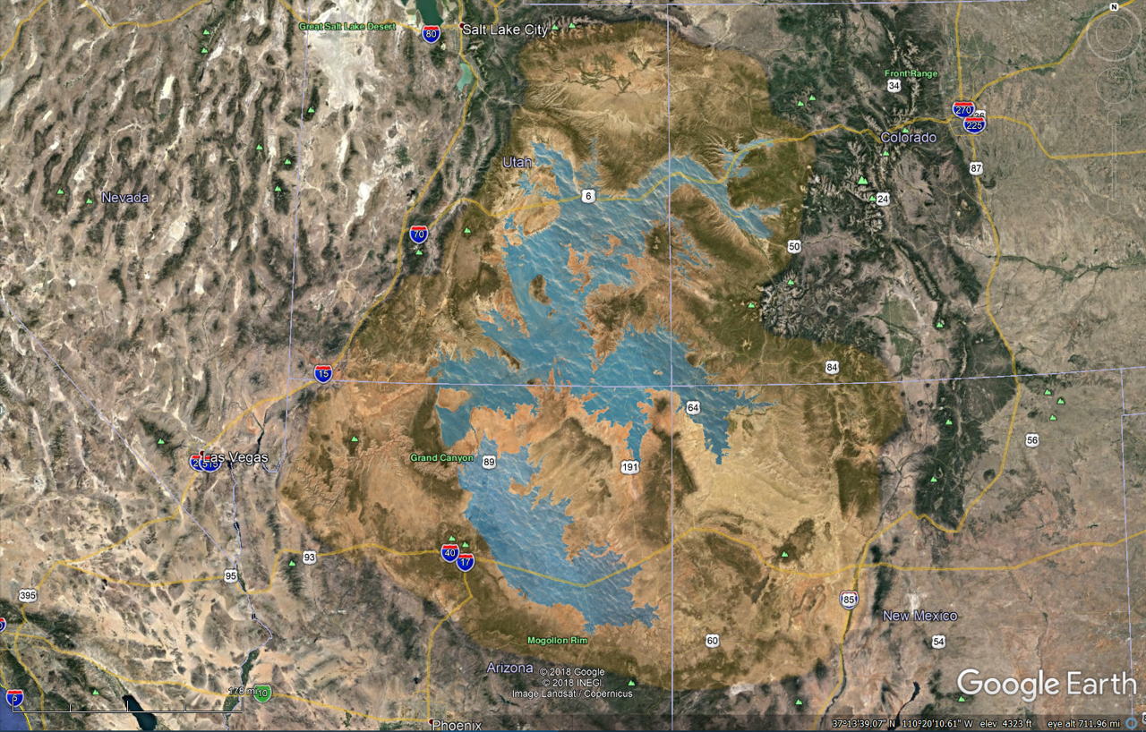
Some of the proposed lakes on the Colorado Plateau
When we examine the big picture of Grand Canyon formation, the issue is not only how the canyon was carved, but what role the surrounding plateau and its history played in that process. Several explanations for the formation of the Grand Canyon have been proposed. Some hold that the Colorado River slowly carved the canyon over long periods of time. A few in the creation community suggest that waters retreating from the global Flood directly cut the canyon as they drained off the continent.
A third view—based on growing field evidence and geology studies—proposes that massive lake systems formed on the plateau and were later released in a catastrophic outflow that rapidly began carving the canyon. This is an idea held by a number of geologists in both the creation and secular science communities. In the creation model, it places the lake spillover or breached dam formation for the Grand Canyon sometime after the Genesis Flood.
Each of these approaches attempts to account for the same feature, but they do not all fit the observations equally well. Let’s take a look…
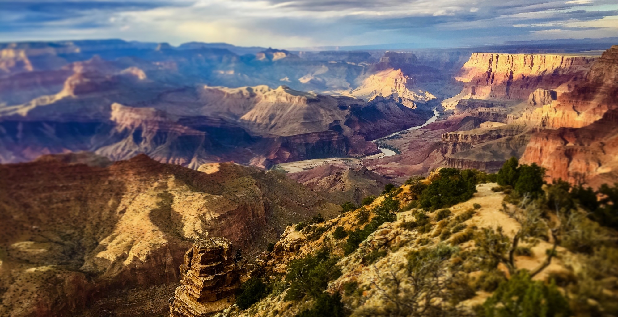
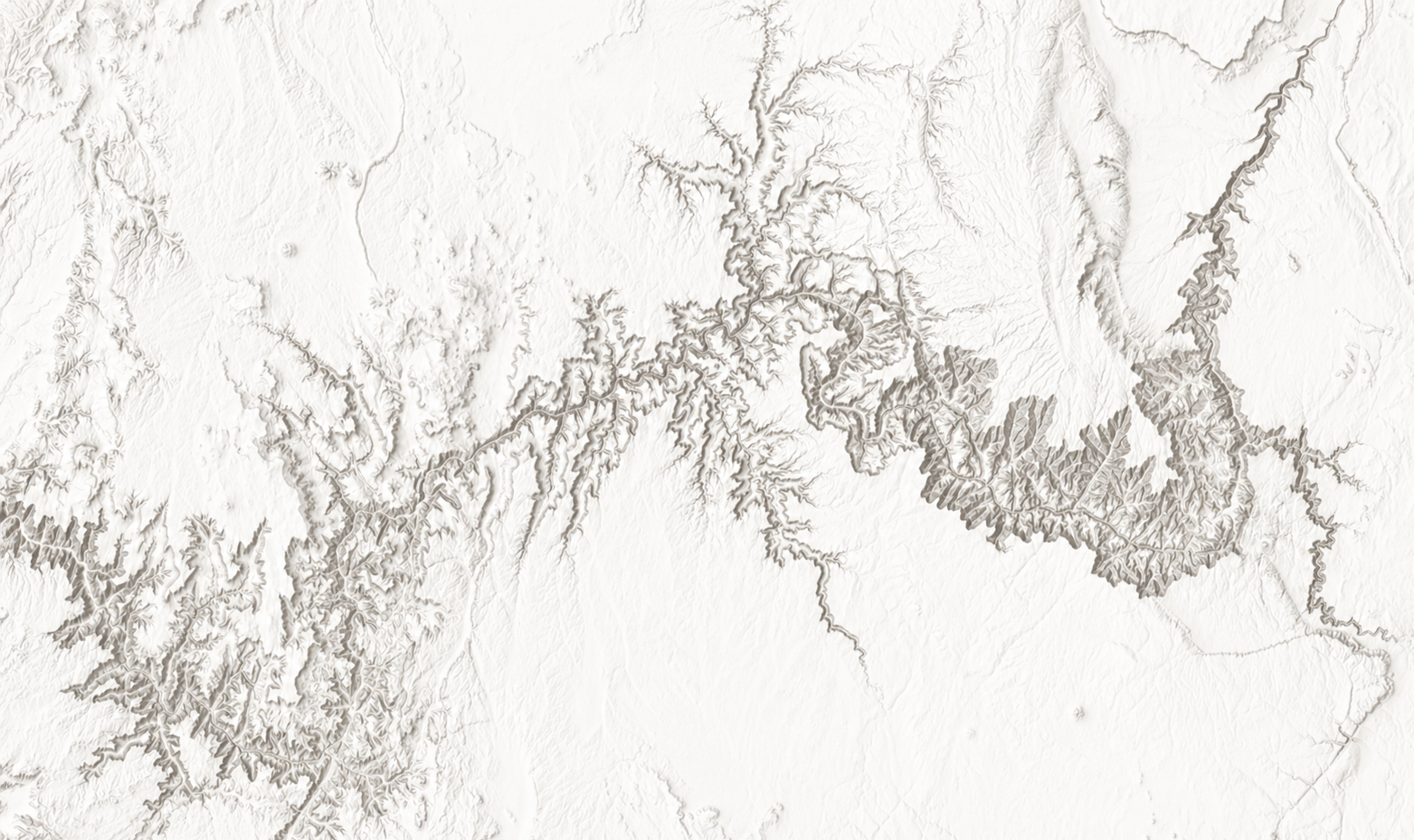 When the canyon itself is considered, the scale immediately stands out. It extends for 277 miles, spans up to 18 miles wide, and reaches depths of over 6,000 feet—representing the removal of around 1,000 cubic miles of rock. At the bottom flows the modern Colorado River, yet the river appears small and underfit in comparison to the canyon it occupies. The mismatch between the size of the river and the size of the canyon raises a fundamental question. Was this river capable of carving such a feature, or is it simply occupying a path that was formed under very different conditions?
The shape of the canyon also deserves careful attention. Its walls are steep and sharply defined. In many places they appear cleanly cut, not gradually worn back. Massive side canyons are present, yet lack a continual cutting force like the Colorado River to explain their existence—a problem often acknowledged by geologists. The presence of such large side canyons without any water source suggests rapid incision rather than slow integration over eons of time. They point instead to a more concentrated and energetic event.
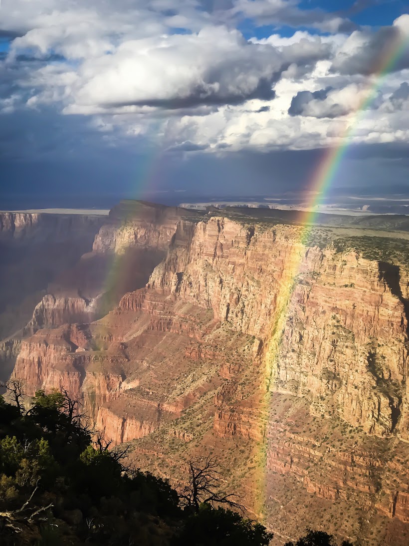 In a biblical framework, the idea that the canyon was carved directly by waters retreating from the Flood also encounters difficulty when compared with what is actually present in the geology. If the canyon formed during the final stages of the Flood, the sediments through which it cuts would have been freshly deposited and water-saturated.
In that condition, they would behave more like soft mud than hardened rock. Erosion under those circumstances would be expected to produce slumping slopes and irregular collapse features. Instead, the canyon displays steep, well-defined walls that suggest the rock had already lithified at least to a degree and become more resistant before it was cut.
This points to a period of time between the deposition of the layers and the carving of the canyon, allowing the sediments to settle, compact, and strengthen. The physical geology seems to indicate the laying down of the sediment and the carving out of the canyon were two separate events, perhaps separated by hundreds of years.
Our observations and teaching at Canyon Ministries do not support the idea that the Grand Canyon was formed during or at the end of the Genesis Flood in Noah’s Day. Rather, we side with the leading model held today by the majority of geologists and paleontologists in the creation community—a model that supports the Grand Canyon formation by a massive post-Flood lake spillover/breached dam mechanism.
This model does not diminish the role of the Flood in Noah’s day in any way. We believe the layers exposed in the canyon, from the Tapeats Sandstone up through the Kaibab Limestone, are best understood as the result of large-scale, rapid deposition that took place during the year-long Flood. These layers extend across vast portions of the plateau and show little evidence of long gaps between them. Some of these layers even extend across multiple continents, demonstrating the size and power of that event.
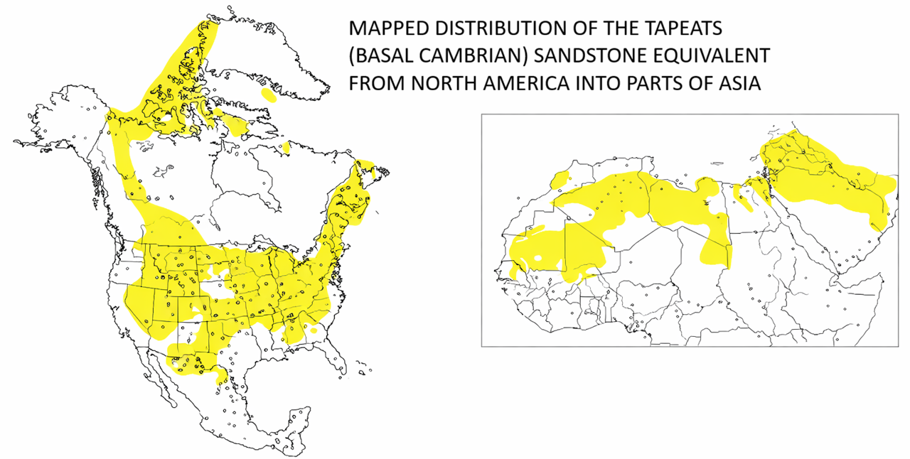
The Flood provides a coherent explanation for their origin and for the broad shaping of the landscape. It also explains the removal of much of the Grand Staircase material that once lay above the present plateau. Through Flood recession and sheet erosion on a massive scale, thousands of feet of sedimentary layers deposited during the Flood were stripped away, leaving behind the beveled and high-standing flat surface of the Kaibab Plateau and surrounding region. The canyon, however, appears to be a later feature cut into that already established framework.
With the Flood setting the stage, the question becomes what happened later. The basin-like form of the Colorado Plateau suggests that water within the plateau would not have drained easily. Today when we look at the Colorado Plateau, many rivers and streams do in fact drain toward the middle. Yet, there is only one major drainage…one crack in the side of the bowl-shaped plateau through which water drains out in any significant amount. That one crack and drainage of water is the Grand Canyon and the Colorado River that flows through it.
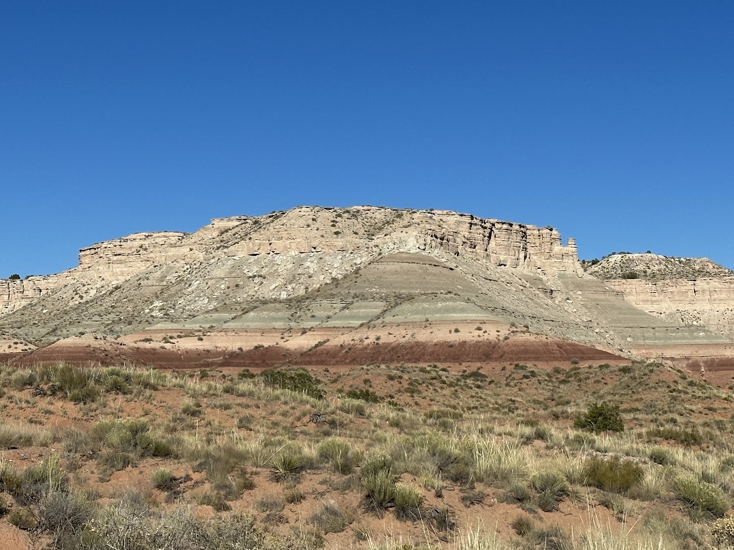
Bidahochi Formation near Hopi Buttes
When we consider the dynamics of the Colorado Plateau and its river systems, a few things become clear. If we didn’t have the Grand Canyon and the Colorado River draining through it, that water would have nowhere to go and would naturally pond up in the interior of the giant bowl, forming massive lakes.
Evidence for these lakes is found in multiple locations across the region, with total volume estimates by some ranging from 5,000 to 6,000 cubic miles. That amount of water, comparable to the combined volume of all five Great Lakes, suggests a landscape that was not simply draining, but actively storing and containing water on a massive scale.
One of the most significant pieces of evidence for these lakes is the Bidahochi Formation, a lakebed sediment deposit a few hundred feet thick, found east of Flagstaff, Arizona, and often associated with what has been called Hopi Lake or Lake Bidahochi. This formation contains greenish lake clays that are consistent with a large freshwater lake that in places was perhaps up to 2,000 feet deep. The fossils found within it are freshwater in nature, not marine, indicating that the formation was not deposited by the Flood, but represents a distinct lake system that formed afterward and likely developed in various phases for the next 700 to 1,000 years before the lakes drained and the canyon was formed. Hopi Lake and the Bidahochi lakebed sediments never could have formed if the Grand Canyon was already cut open, as there would be no way to impound the water to form the lake. It would have simply continually drained through there, as it does today.
Additional evidence strengthens this picture. Features interpreted as shoreline terraces have been identified across portions of the plateau. These appear as laterally consistent benches that follow contour lines and suggest former water levels. Their geometry indicates a transgressive filling lake system rather than one that was simply draining away. In other words, the water was rising and spreading across the landscape for some time, not merely receding from it all in one go at the end of the Flood.
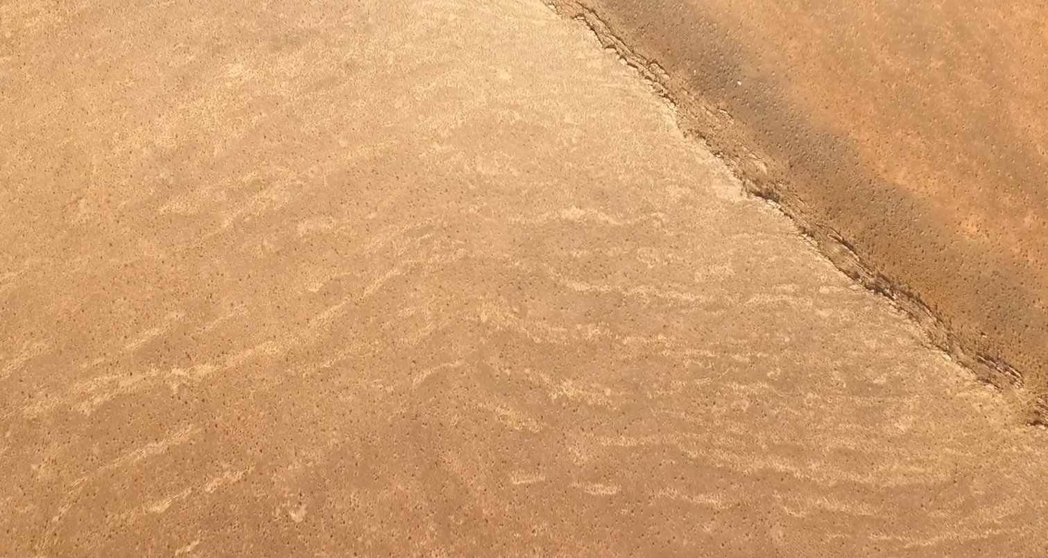
Proposed lake shoreline/terrace features of Hopi Lake in the Bidahochi Basin east of Flagstaff, Arizona
In a setting like this, the presence of a large lake introduces a critical threshold. As water accumulates, it eventually begins to spill over or through the containment wall of the Kaibab Plateau. The moment that overflow begins, even in a small way, erosion is set in motion. Flowing water cuts into the barrier, which deepens the channel, allowing increasingly more water to pass through. This is not a slow, balanced process. It is a self-accelerating runaway process. What begins as a trickle can rapidly become a powerful and catastrophic outflow.
Once a breach develops, the stored water is released with tremendous force. The resulting flow is focused, deep, and energetic. Under such conditions, water mixed with a slurry of rocks and boulders is capable of cutting through hardened sedimentary rock and removing vast quantities of material in a relatively short period of time—especially when the cutting power of cavitation is also considered. This kind of process aligns closely with the physical form of the Grand Canyon. The steep walls, the depth of incision, and the scale of material removed all point to a high-energy event rather than a slow and gradual one.
The reason this explanation has gained traction in the geologic community is not simply because it is plausible, but because it is grounded in observation. The cut nature of the canyon, the evidence for large freshwater lakes in formations such as the Bidahochi, the presence of features consistent with rising water levels, and the overall shape of the plateau all point in the same direction. This is also the conclusion reached by most creation geologists who have spent significant time studying the canyon and the surrounding region through boots-on-the-ground research in the field. It is not based on distant speculation, but on direct examination of the rocks, the landforms, and the relationships between them. Our own team, having spent decades working and exploring in this region, has come to the same conclusion through continued observation and study.
 Within a biblical framework, this sequence is straightforward. The Flood deposits the horizontal sedimentary layers and shapes the broad surface of the plateau. After the Flood, water collects in large basins, forming extensive lakes. As those lakes fill, they eventually breach their natural boundaries. The sudden release of that water rapidly carves the canyon. The modern Colorado River then remains as a reduced flow within a channel that was formed under far more powerful conditions.
There is a canyon, not because there is a river. There is a river, because there is a canyon. The canyon came first, and the Colorado River simply takes advantage of this low pathway off the Colorado Plateau. The breached dam model shows us how the canyon was formed by a lot of water, in a little bit of time.
There is still work to be done. Ongoing research continues to examine the extent of these lake systems, the nature of the shoreline features, and the pathways through which water was released. These studies aim to refine the details and test the model against additional evidence. What is already clear, however, is that the Grand Canyon does not fit comfortably within a slow or simple explanation of Colorado River carving. Nor does it fit within a Flood carved or recession model. Its scale, its form, and its setting point to a powerful and focused post-Flood event. The catastrophic release of water from large lakes on the Colorado Plateau provides a clear and coherent way to understand how that event took place.

Watch this video with Dr. Steve Austin and Dr. Del Tackett to learn more about the model most creation geologists hold to regarding a post-Flood lake spillover event for the formation of the Grand Canyon.

Dante Pamintuan
Thank you for your post. Informative and awe inspiring. It amazes me how great our God is when it comes to his creation. With this conclusion, we must never forget how much God loves us by preparing this Grand Canyon/Colorado River system to benefit mankind for generations to come. To God be the glory!
Woody
Thanks Nate. I 1st heard you discuss this when with you at the bottom.
Seems like researchers should be able to match soil now in the Gulf of California as additional support of this event. Any comment on this?
Matt Stewart
When I went down the river in 2010 with Tom and Andrew and Carl, they were mentioning the lake hypothesis but I remember specifically Tom saying that there was a lack of evidence. Wow has a lot changed in 25 years!
Another thing I remember asking is if the material from the canyon is in the Gulf of California and Tom said no there is no trace of it. That seems really interesting that there is no trace of the excavated material from the carving of the Canyon. Perhaps that speaks of transportation forces like nothing we’ve ever imagined outside the Flood? But as the energy dissipated from the draining, cavitating waters, there should be all kinds of rock layers left over from the flush it seems. Perhaps you could speak to this in an article.
Nate Loper
There is indeed Grand Canyon sedimentary material in the Gulf of California, but not near the amount needed to account for all that’s been removed from the canyon. Rather than finding most of that in the Gulf of California and the Sea of Cortez where the Colorado River ends, we actually find a good deal of that material in parts of the Mojave Desert, Anza Borrego Desert, and even the Los Angeles basin. It seems possible that much of it was washed out to sea during the breaching event. -Nate